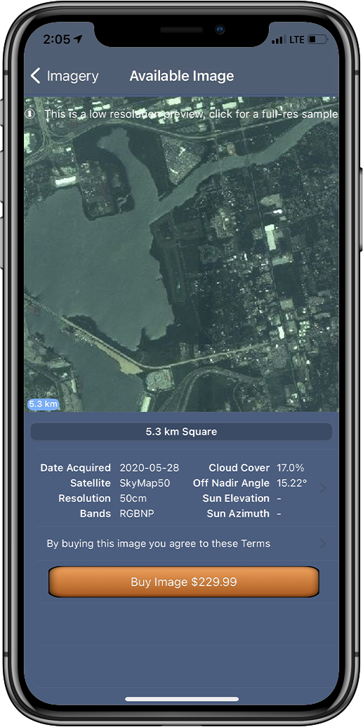
SpyMeSat
  • Home
  • About
    • FAQ
    • Mobile Application
    • Web Application
    • Satellites
  • Features
    • Archive Imagery >
      • Maxar
      • Planet
      • KOMPSAT
      • TeLEOS
      • SkyMap50
    • New Tasking
    • Overflight Notifications
  • Pricing
  • Contact
  • Buy Imagery Now

SkyMap50

Soar's SkyMap50 Imagery Archive

SkyMap50 is a personally branded wholesale satellite imagery product by Soar.Earth. Launched in 2018 (01 & 02) and 2018 (03 & 04) from the Taiyuan Satellite Launch Center in China, the four syn-synchronous satellites operate at an altitude of 500km and can monitor daily any location on the Earth at 50cm per pixel image resolution. At this zoom level, ground features such as individual trees, fences, cars and trucks can be all seen.
Picture

Specifications:

Image Size
Picture

5.3km²

Resolution
Picture

50cm

File Format
Picture
SkyMap50 archival imagery orders can take between 2 to 5 working days to process and is available only in GeoTIFF format. You'll receive an email and a push notification when your image is ready.

Imagery on this page provided by Soar's SkyMap50
Picture
Resources
Picture
Visit the Soar Website
Picture
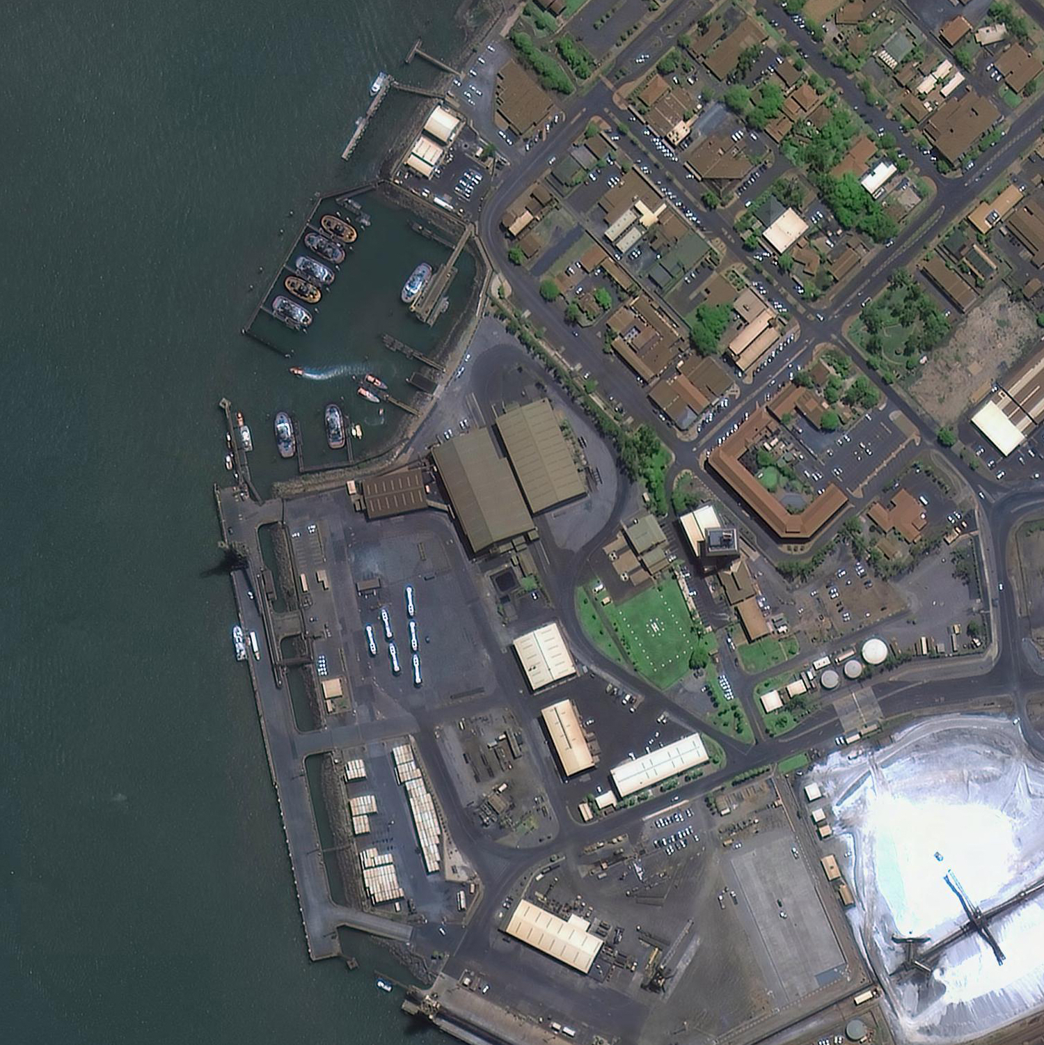
Download a Full-Resolution
​Sample SkyMap50 Image
Picture
Read the Soar SkyMap50
End User License Agreement​
U.S. Patents 9344994, 9779301, 10853410, 10817561, and 11113330
© Orbit Logic | All Rights Reserved
  • Home
  • About
    • FAQ
    • Mobile Application
    • Web Application
    • Satellites
  • Features
    • Archive Imagery >
      • Maxar
      • Planet
      • KOMPSAT
      • TeLEOS
      • SkyMap50
    • New Tasking
    • Overflight Notifications
  • Pricing
  • Contact
  • Buy Imagery Now