Satellite Details
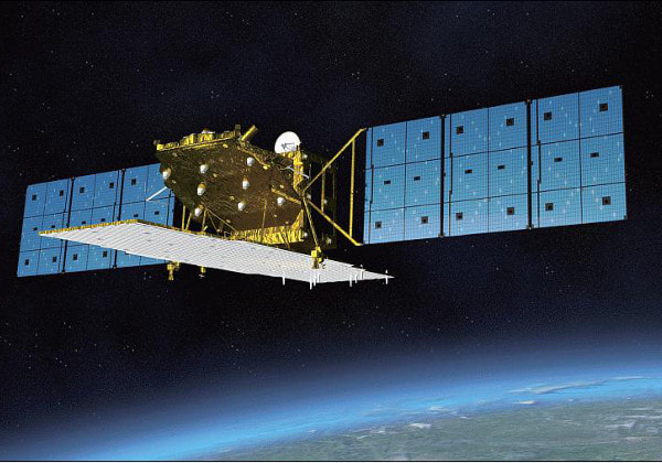
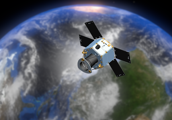
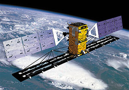
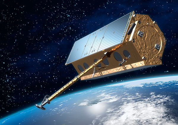
ALOS-2The second Advanced Land Observation Satellite (ALOS-2) also known as DAICHI-2 was launched into orbit May 24, 2014. ALOS-2 is a radar Earth observation satellite. ALOS-2 was manufactured by Mitsubishi Electric Corporation. The satellite supports stripmap, spotlight, and ScanSAR imaging modes capable of 1-3 meter resolution. ALOS-2 operates in a near-circular sun-synchronous orbit with a revisit time of 14 days. The satellite is operated by the Japan Aerospace Exploration Agency (JAXA) and provides significant Earth observation services for disaster monitoring, environment protection, resource exploration and forest monitoring.
|
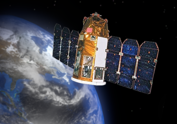
AlSat-2A & AlSat-2BAlSat-2A and 2B were built by Astrium for the Algerian National Space Technical Center (CNTS). AlSat-2A (116 kg) was launched on July 12, 2010 on a PSLV-CA rocket from the Satish Dhawan Space Center. The two-satellite system will enable the Algerian Government to take high-resolution images for use in a variety of applications, such as cartography, management of agriculture, forestry, water, minerals and oil resources, crop protection, management of natural disasters, and land planning.
|
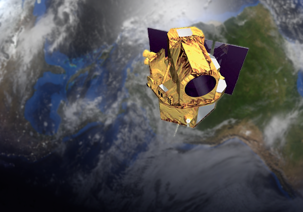
ASNAROThe ASNARO-1 spacecraft was launched on November 6, 2014 on a Dnepr-1 vehicle from Dombarovsky, Russia. The Advanced Satellite with New system Architecture for Observation (ASNARO) is a Japanese satellite developed by NEC Corporation under funding from NEDO (New Energy and Industrial Technology Development Organization), a Department of METI (Ministry of Economy, Trade and Industry) of the Government of Japan. The satellite operates in a sun synchronous polar orbit. The satellite provides high resolution optical images at better than 0.5m panchromatic (black and white) resolution and better than 2m resolution multispectral (color) images with an imaging swath width of 10km. The ASNARO spacecraft will be operated and controlled by a data center with two fixed ground stations located in Okinawa and Hokkaido, Japan. A mobile ground station is also used to support ASNARO operations.
|
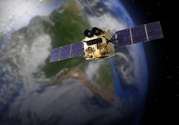
BelKa-2The BelKa-2 Satellite is a remote imaging satellite built by NPP VNIIEM for the National Academy of Sciences of the Republic of Belarus. It replaces the BelKa-1 satellite that was lost in a launch failure. The satellite was launched on July 22, 2012 at 6:24 UTC on a Soyuz-FG rocket out of Baikonur launch center, Kazakhstan. The 2.1 meter resolution panchromatic (swath width 20 km) and 10.5 meter multispectral (swath width 250 km) images will be put to use in mapping, large-scale building projects, geological investigations, and environmental monitoring.
|
Carbonite-1CARBONITE-1 is a small (80kg) demonstration satellite built by Surrey Satellite Technology, Ltd in the United Kingdom. The satellite provides 1m resolution imagery at nadir with a 5km swath width. The satellite was built and tested in 6 months using a commercial-off-the-shelf telescope with 25cm mirrors and a commercial-off-the-shelf video camera, both modified by SSTL for space. The video camera provides 15 seconds of HD video clips at 1m resolution. An X-band transmitter provides 80Mpps downlink of image and video data. CARBONITE-1 also flies an Icarus-3 de-orbit sail from Cranfield University. SSTL’s aim is to lower the mass, increase the imaging and video capability, and reduce the build and test schedule to deliver a launch-ready spacecraft in 3 months to address the market for high resolution, daily revisit Earth observation missions.
|
Carbonite-2
Carbonite-2 is the second small satellite in the 15 satellite constellation being produced by Surry Satellite Technology Ltd. for the British company Earth-I, in efforts to create a satellite constellation that has the ability to take high-resolution, full color images and high-definition video of any point on earth. Carbonite-2 was launched into a 507 km sun synchronous orbit on January 12, 2018 at 3:59 GMT from the Satish Dhawan Space Center on a PSLV rocket and will offer 1 meter resolution full color images and video At Nadir with a 5 km swath width. The satellite achieves this with a commercial-off-the-shelf telescope. The satellite is cube-shaped with each side being 65 cm long and weighing 100 kg at launch. Earth-I’s plan for the 15 sub-meter satellite constellation is to provide true color, high-quality images and video at 60 cm resolution with intra-day revisit times and rapid tasking to provide businesses and governments near real-time images and video for quick decision making.
CartoSat-2AThe CartoSat-2A satellite is the thirteenth satellite in the Indian Remote Sensing (IRS) satellite series to be built, launched and maintained by the Indian Space Research Organisation. The highly agile satellite can be steered up to 45 degrees along as well as across the direction of its movement to facilitate imaging of any area more frequently. CartoSat -2A is capable of capturing black and white imagery with .8 meter resolution. CartoSat -2A was launched in April 2008. The satellite's health is monitored from the Spacecraft Control Centre at Bangalore with the help of ISTRAC network of stations at Bangalore, Lucknow, Mauritius, Bearslake in Russia, Biak in Indonesia, and Svalbard in Norway. The originally planned operational life span of CartoSat -2A was 5 years, which was surpassed in early 2012.
|
CartoSat-2B
The CartoSat-2B satellite is the seventeenth satellite in the Indian Remote Sensing (IRS) satellite series to be built, launched and maintained by the Indian Space Research Organisation. The highly agile satellite is capable of capturing black and white imagery with .8 meter resolution giving users close views of cities, neighborhoods, natural resources and military sites around the world. The imagery will have applications in resource mapping, urban planning, transportation studies, water monitoring, and crop inventories. CartoSat-2B was launched in July 2010. The planned operational life span of CartoSat-2B was 5 years, which extends to 2015.
CartoSat-2C
Cartosat-2C is an Earth observation satellite in a sun-synchronous orbit and is a fifth flight unit of Cartosat series of satellites. The satellite is built at Space Applications Centre (SAC) in Ahmedabad, and is operated and maintained by the Indian Space Research Organisation. It was launched onboard a PSLV rocket on June 22, 2016 from the second pad of the Satish Dhawan Space Centre in India. The satellite carries a panchromatic (PAN) camera capable of taking black-and-white pictures with a spatial resolution of 0.6 meters. It also carries a High-Resolution Multi-Spectral imager. The imagery of Cartosat-2 series satellite will be useful cartographic applications, urban and rural applications, military applications, coastal land use and regulation, utility management like road network monitoring, water distribution, creation of land use maps, precision study, change detection to bring out geographical and manmade features and various other Land Information System (LIS) and Geographical Information System (GIS) applications.
CartoSat-2D
Cartosat-2D is an Earth observation satellite developed by the Indian Space Research Organisation (ISRO), and is the sixth in the Cartosat series. It is designed to collect high-resolution, large-scale imagery for use in urban planning, infrastructure development, utilities planning, and traffic management. The satellite was launched on 15 February 2017 aboard a PSLV rocket from the Satish Dhawan Space Centre in India. With a mass of 712 kilograms (1,570 lb), it was deployed into a 505-kilometer (314 mi) Sun-synchronous orbit for a five-year primary mission. Cartosat-2D carries two primary instruments: the Panchromatic Camera (PAN) and the High-Resolution Multi-Spectral radiometer (HRMX). PAN is capable of taking panchromatic (black and white) photographs in a selected portion of the visible and near-infrared spectrum (0.50–0.85 µm) at a resolution of 65 centimeters (26 in). HRMX is a four-channel radiometer sensitive across the entire visible spectrum and part of the near-infrared spectrum (0.43–0.90 µm) at a resolution of 2 metres (6.6 ft).
CartoSat-2E
Cartosat-2E is an Earth observation satellite developed by the Indian Space Research Organisation (ISRO), and is the seventh in the Cartosat series. It is designed to collect high-resolution, large-scale imagery for use in urban planning, infrastructure development, utilities planning, and traffic management. The satellite was launched on 23 June 2017 aboard a PSLV-XL rocket from the Satish Dhawan Space Centre in India. With a mass of 712 kilograms (1,570 lb), it was deployed into a 505-kilometer (314 mi) Sun-synchronous orbit for a five-year primary mission. Cartosat-2E carries two primary instruments: the Panchromatic Camera (PAN) and the High-Resolution Multi-Spectral radiometer (HRMX). PAN is capable of taking panchromatic (black and white) photographs in a selected portion of the visible and near-infrared spectrum (0.50–0.85 µm) at a resolution of 65 centimeters (26 in). HRMX is a four-channel radiometer sensitive across the entire visible spectrum and part of the near-infrared spectrum (0.43–0.90 µm) at a resolution of 2 metres (6.6 ft).
COSMO-Skymed - 1, 2, 3, & 4COSMO-SkyMed (COnstellation of small Satellites for the Mediterranean basin Observation) is a constellation of 4 Synthetic Aperture Radar (SAR) imagery satellites conducted by the Italian Space Agency for civil and military use. Its main applications are maritime awareness, defense and intelligence, thematic mapping, emergency response, and land stability analysis. The constellation was launched over 3.5 years beginning June 2007 with the final satellite launching in November 2010. The number of satellites in conjunction with the use of a SAR sensor allows for observations of an area of interest to be repeated several times a day in all-weather conditions. The COSMO-SkyMed satellites have three basic types of imaging modes: Spotlight, a high-resolution mode collected over a small area by steering the radar beam slightly fore-to-aft during the collection period. Stripmap, a medium-resolution mode collected over long, continuous swaths in which the beam is pointed broadside to the satellite track. ScanSAR, a low-resolution mode that creates extra-wide swaths by collecting short segments at different ranges and then mosaicking them together.
|
DEIMOS-2DEIMOS-2 is Spain's first high resolution imaging satellite. The satellite is owned and operated by Elecnor Deimos, and was built in cooperation with Satrec Initiative of South Korea. DEIMOS-2, was launched into orbit from the Yasny launch base in Russia on June 19, 2014. This panchromatic and multispectral (optical) agile satellite weighs 300 kg and measures 1.5 x 2 m, incorporates a camera that achieves high precision and detailed images of Earth with a resolution of 75 cm per pixel and a capacity of 150,000 km2/day with bands in RGB, NIR and panchromatic. DEIMOS-2 has a standard imaging swath width of 12km and an extended swath mode 24km wide, and can take images up to 45 degrees off-nadir. The satellite is expected to have an operational lifetime of seven years, and will contribute the following areas: agriculture, environment, climate change, crisis control and civil protection (fires and floods), as well as defence, intelligence and border control. DEIMOS-2 is operated from Elecnor Deimos' Puertollano Satellite Integration and Operations Centre (Ciudad Real), a complex for integrating and managing its own and third-party satellites. Equipped with the latest technology, it has engineering areas; a 400+ m2 clean room, for satellite integration and testing; a dual S-band/X-band antenna with a diameter of 10.2 m to communicate with satellite; and a Control Centre.
|
DubaiSat-1DubaiSat-1 is a remote sensing Earth observation satellite built fof the Emirates Institution for Advanced Science and Technology (EIAST) under an agreement with Satrec Initiative. Dubaisat-1 was designed and developed by Satrec Initiative, with participation from EIAST engineers. DubaiSat-1 was launched on July 29, 2009 into a 680 km altitude sun-synchronous polar orbit from the Baikonur launch site in Kazakhstan, onboard a Dnepr launch vehicle. DubaiSat-1's camera generates high-resolution optical images at 2.5m in panchromatic and at 5m in multispectral bands. These images are used by decision makers in the UAE (as well as other EIAST clients) for a wide range of applications including infrastructure development, urban planning, and environment monitoring and protection. The United Nations also used DubaiSat-1 images to monitor relief efforts following the 2011 Tōhoku earthquake and tsunami in Japan. Dubaisat-1 is controlled and monitored from EIAST's Ground Station is located in Dubai, UAE, and collected images are downlinked to the same ground station.
|
DubaiSat-2DubaiSat-2 is a remote sensing Earth observation satellite built fof the Emirates Institution for Advanced Science and Technology (EIAST) under an agreement with Satrec Initiative. Dubaisat-2 was designed and developed by Satrec Initiative, with participation from EIAST engineers. DubaiSat-2 was launched on November 21, 2013 into a 680 km altitude sun-synchronous polar orbit from the Baikonur launch site in Kazakhstan, onboard a Dnepr launch vehicle. DubaiSat-1's camera generates high-resolution optical images at 1m in panchromatic (black & white) and at 4m in multispectral (color) bands with a swath width of 12km. These images are used by decision makers in the UAE (as well as other EIAST clients) for a wide range of applications including infrastructure development, urban planning, and environment monitoring and protection. Dubaisat-2 is controlled and monitored from EIAST's Ground Station is located in Dubai, UAE, and collected images are downlinked to the same ground station.
|
EROS-AEarth Resources Observation Satellite (EROS) is a series of Israeli commercial Earth observation satellites, designed and manufactured by Israel Aircraft Industries (IAI), with optical payload supplied by El-Op. The satellites are owned and operated by ImageSat International, another Israeli company. EROS A was launched in December 2000. The EROS-A satellite design was based off of the Israeli military reconnaissance satellite Ofeq 3. EROS-A is capable of capturing black and white imagery with an resolution of 1.8 meters. The anticipated operational lifespan of EROS-A is 14 years, which will extend into late 2014.
|
EROS-B
The EROS-B satellite is the second of the EROS series of satellites designed for Israeli commercial/military use. EROS-B was launched in April 2006 aboard a Russian Start-1 rocket from the Svobodny Launch Complex in eastern Siberia. Its design is based off of the EROS-A platform. EROS-B is capable of capturing .7 meter resolution black and white imagery with an imager more sophisticated than its predecessor, EROS-A. The satellite was launched in order to address market demand for higher resolution and faster revisit of EROS constellation satellites. The anticipated operational lifespan of EROS-B is 14 years, which extends into 2020.
FORMOSAT-2FORMOSAT-2 is a high-resolution optical satellite able to revisit the same point on the globe every day in the same viewing conditions. It is well suited to change detection and rapid coverage of large areas in black & white or in color. FORMOSAT-2 was developed by National Space Organization (NSPO) of Taiwan to conduct remote sensing imaging over Taiwan and on terrestrial and oceanic regions of the entire earth. FormoSAT-2, originally called Rocsat-2, was launched in May 2004. FORMOSAT-2 is capable of 2 meter resolution black and white and color imagery and 8 meter multispectral imagery. It has a mission life of 5 years and design life of 7 years, both have which were surpassed in May of 2011.
|
FORMOSAT-5
The FORMOSAT-5 Satellite is Taiwan’s first indigenously developed imaging satellite. It was launched into a sun synchronous orbit with an altitude of 720km and a revisit time of 2 days by a SpaceX Falcon 9 rocket on August 24, 2017 at 18:51 GMT from the Vandenburg Air Force base. It has a mission life of 5 years which will end in 2022. FORMOSAT-5 was constructed and is operated by The National Space Organization of Taiwan (NSPO) and is used to build up the domestic high resolution remote imaging capabilities of Taiwan. The satellite is octagonal, 3 m in height and 1.2 m in diameter and weighing 525 kg. It can take multispectral (color) images with a resolution of 4 meters and panchromatic (black and white) images with a resolution of 2 meters, both when weather permits.
Gaofen-1Gaofen-1 is the first in a series of planned Chinese high-resolution Earth observation satellites and is part of the CHEOS program initiated in 2010 by CNSA (Chinese National Space Administration). Major users of the observation data include the Ministry of Land and Resources, the Ministry of Environmental Protection, and the Ministry of Agriculture. Gaofen-1 is based on the CAST small satellite bus designed and built by China SpaceSat Co. Ltd., the commercial subsidiary of the Chinese Academy of Space Technology (CAST). Gaofen-1 was launched on April 26, 2013 on a Long March 2D rocket from the Jiuquan Satellite Launch Center in northwest China. Gaofen-1 has a high resolution camera that can image 60km-wide swaths with 2m black & white resolution (8m color), as well as a Wide Field Imager that can take an 800km-wide swath of imagery at 16km resolution using a set of 4 cameras.
|
Gaofen-2Gaofen-2 (gao fen = high resolution) is the in a series of Chinese high-resolution optical Earth observation satellites and is part of the CHEOS (China High-resolution Earth Observation System) program initiated in 2010 by CNSA (China National Space Administration). The CHEOS series will consist of seven imaging satellites. The major users of the observation data will be the Ministry of Land and Resources, Ministry of Environmental Protection, and the Ministry of Agriculture. Gaofen-2 is based on the CS-L3000A satellite bus and has an expected lifetime of 4-8 years. The Gaofen-2 spacecraft was launched on August 19, 2014 on a Long March-4B (Chang Zheng-4B) rocket from the LC9 launch complex of the Taiyuan Satellite Launch Center, and placed in a sun-synchronous orbit. Gaofen-2 can take images as good as 80cm resolution (black & white), and as good as 3.2m resolution (color), with an imaging swatch width of 48km.
|
Gaofen-3Gaofen-3 is an Earth imaging radar satellite using a synthetic aperture radar (SAR) to capture images with a resolution of 1 meter at nadir and can cover a ground swath of 10 to 650 km depending on which of the 12 imaging modes is used. It was launched on August 9, 2016 at 10:55 GMT into a 741 km polar orbit on board a Long March 4C. Gaofen-3 features high stability and high agility using a combination of control moment gyros and momentum wheels to quickly turn the 2,950 kg satellite. Development of Gaofen-3, which is based on the CS-L3000B bus, started in 2010 in Beijing at the China Academy of Space Technology (CAST). The flight unit being finished in May of 2016 for final testing and shipment to Jiuquan Launch Center for its August 9th launch. Gaofen-3 has a mission duration of 8 years, to end in 2024. The satellite’s main purpose is environmental monitoring and disaster warning.
|
GeoEye-1The GeoEye-1 spacecraft (formerly known as Orbview-5) was designed and developed under the US National Geospatial-intelligence Agency's Nextview Program. This agile satellite provides the U.S. military and intelligence community, as well as the commercial remote sensing industry, greater access and priority to high-resolution black and white and color commercial satellite imagery. GeoEye-1 is capable of acquiring image data at 0.41 meter panchromatic (black and white) and 1.65 meter multispectral (color) resolution. It has a target revisit time of less than three days, as well as the ability to locate an object within just three meters of its physical location. The satellite travels at approximately 16,800 mph and collects up to 700,000 square kilometers of imagery in a single day ~ an area nearly the size of Chile. GeoEye-1 was launched in September 2008. The satellite has a planned operational life of 7 years, which extends to fall of 2015, but is expected to be fully functional until at least 2018. GeoEye-1 was manufactured by General Dynamics and is owned and operated by DigitalGlobe.
|
Göktürk-1A
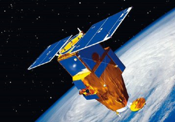
The Göktürk-1A is a high-resolution Earth Imaging Satellite operated by the Turkish Ministry of Defence. The satellite was developed and built by Telespazio, Italy as the prime contractor with Thales Alenia Space providing the spacecraft bus. sensing satellite built by Turkey. Its imaging payload has a top resolution of 2.5 meters (8.2 feet) according to Tubitak, the Scientific and Technological Research Council of Turkey. Turkey will use Göktürk-2 data for security, disaster response, environmental mapping, urban planning, coastal zone monitoring and water resource management. The optical payload will take pictures with an image swath width of 20 kilometers (about 12 miles). Göktürk-2 weighs about 900 pounds (408 kg). he satellite collects black-and-white imagery at a ground resolution of 70 centimeters and full color images at 2.5 meters with a re-visit time over the Turkish territory of under two days. The instrument has an aperture of 65cm, covers a ground swath of 20 Kilometers at nadir, and can support off-nadir imaging at angles of up to 30 degrees. Imagery delivered by the satellite will primarily be used for reconnaissance with secondary applications in mapping, urban planning, environmental monitoring, disaster management, coastal zone monitoring and resource management.The launch of Göktürk-1A was delayed multiple times due to political issues. Israel objected to the launch of the satellite expressing concerns that imagery taken of their territory may fall into the wrong hands. Israel was responsible for supplying some of the optical components of the satellite and requested that the satellite would have a built-in restriction to prevent images being taken over their territory. Turkey rejected these demands and pressured the satellite manufacturer to prove Göktürk-1A can be operated without geographical restriction.
Göktürk-2The Göktürk-2 global reconnaissance satellite was built in Turkey by TBITAK UZAY and Turkish Aerospace Inc. (TAI). The satellite is the second remote sensing satellite built by Turkey. Its imaging payload has a top resolution of 2.5 meters (8.2 feet) according to Tubitak, the Scientific and Technological Research Council of Turkey. Turkey will use Göktürk-2 data for security, disaster response, environmental mapping, urban planning, coastal zone monitoring and water resource management. The optical payload will take pictures with an image swath width of 20 kilometers (about 12 miles). Göktürk-2 weighs about 900 pounds (408 kg).
|
The International Space Station (ISS)The International Space Station (ISS) is a multi-nation space construction project. The ISS project includes 5 space programs and 17 nations including Russia, the United States, Japan, Canada, Austria, Belgium, Denmark, France, Germany, Italy, the Netherlands, Norway, Portugal, Spain, Sweden, Switzerland, and the United Kingdom. The first component, Zarya, was launched into orbit on a Russian Proton rocket on November 20, 1998. Many more components followed on Proton rockets, Soyuz rockets, and the Space Shuttle, the last module was fitted in 2011 on the last Space Shuttle launch. The station has been inhabited continuously for 17 years, ever since Expedition 1 in 2000. The ISS is used as an orbital science platform to study biology, physics, astronomy, meteorology, and many other fields.
|
Jilin-1 Optical-AThe Jilin-1 Optical A satellite is a Chinese remote imaging satellite made and operated by Chang Guang Satellite Technology Co. and one of the first 4 Jilin satellites to launch into orbit. The satellite was placed in a 650 km sun-synchronous orbit by a Chinese Long March 2D rocket out of Jiuquan Launch Center along with Jilin-1 Video-01, Jilin-1 Video-02 and a technology demonstrator satellite on October 7, 2015 at 4:13 UTC. The Name Jilin comes from a province in north-eastern China. The plan is to put close to one hundred small CubeSats into orbit to allow for very short revisit times (a planned 30 minutes). The Main Payload is a 0.72 m panchromatic (Black and White) camera and a 2.88 m Multispectral (Color) Camera to allow high resolution black and white as well as color pictures to be taken of earth. The pictures will be used for planning for natural disasters, resource exploration, as well as various monitoring tasks.
|
Jilin-1 Video SatellitesThe Jilin-1 Video satellites are part of an ongoing project to create an ultra-high definition CubeSat video network with a very short revisit time. The initial plans for the video constellation are a 30 minute revisit time with 60 satellites in 2020, but could be expanded to 138 satellites in 2030 with an average revisit time of 10 minutes.
|
- The Jilin-1 Video-05 satellite was launched along with two other Jilin-1 video satellites (Jilin-1 Video-04 and Jilin-1 Video-06) on November 21, 2017 on board a Chang Zheng-6 rocket out of Taiyuan Launch Center.
- The Jilin-1 Video-06 satellite was launched along with two other Jilin-1 video satellites (Jilin-1 Video-04 and Jilin-1 Video-05) on November 21, 2017 on board a Chang Zheng-6 rocket out of Taiyuan Launch Center.
- The Jilin-1 Video-07 satellite was launched along with the previous Jilin-1 satellite (Jilin-1 Video-08) on January 19, 2018 on board a Chang Zheng-11 rocket out of Jiuquan Launch Center.
- The Jilin-1 Video-08 satellite was launched along with the previous Jilin-1 satellite (Jilin-1 Video-07) on January 19, 2018 on board a Chang Zheng-11 rocket out of Jiuquan Launch Center.
Kanopus-V-IK-1The Kanopus V-IK-1 satellite is a Russian remote sensing satellite built by NPP VNIIEM for Roscosmos. The satellite was originally built as Kanopus-V 2. It was then modified to support infra-red imaging as small as 5 meters for detecting sources of fire. The imaging payload can take panchromatic (black and white) images of up to 2.1 meter resolution and multispectral (color) images of 10.5 meter resolution. The satellite was launched into a 507 kilometer orbit on July 14, 2017 on a Soyuz-2-1a Fregat-M rocket from Baikonur launch center in Kazakhstan.
|
KazEOSat-1KazEOSat-1 was built by Airbus Defence and Space, and was launched on 28 April 2014 into low Sun-synchronous orbit (about 700 km from Earth) on-board a Vega launcher from the European spaceport in Kourou (French Guiana). KazEOSat-1 is the Republic of Kazakhstan’s first Earth observation satellite weighs 900 kg, and includes a high resolution (1m black & white and 4m color) camera with a ground swath width of 10km. KazEOSat-1 will provide the Republic of Kazakhstan with a complete range of civil applications, including monitoring of natural and agricultural resources, the provision of mapping data, security applications, and support for rescue operations in the event of natural disasters. Kazakhstan engineers trained by Airbus Defence and Space will operate and control the satellite from a control center in Kazakhstan.
|
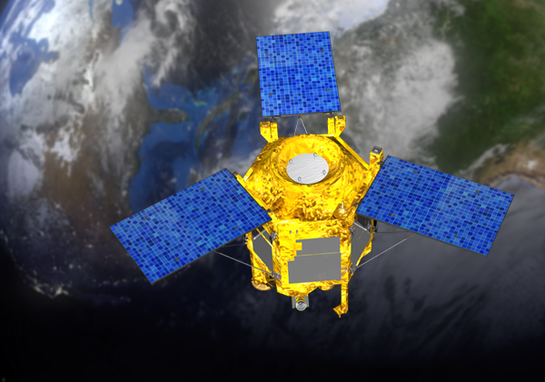
KOMPSAT-2Kompsat-2 (Korea Multi-Purpose Satellite-2), also referred to as Arirang-2, is a South Korean imaging satellite developed and operated by the Korean Aerospace Research Institute (KARI). The main mission objectives of the Kompsat-2 system are surveillance of large scale disasters, acquisition of independent high resolution images (as good as 1 meter black & white and 4 meter color) for Geographic Information Systems (GIS), and composition of printed maps and digitized maps for domestic and overseas territories.
|
KOMPSAT-3KOMPSAT-3 is a high-resolution optical observation satellite developed and operated by the Korean Aerospace Research Institute (KARI). The mission is funded by the Korean Ministry of Education, Science and Technology. The objective of KOMPSAT-3 is to provide observation continuity from the KOMPSAT-1 and KOMPSAT-2 missions to meet the nation's needs for high-resolution optical imagery required for Geographical Information Systems (GIS) and other environmental, agricultural and oceanographic monitoring applications. KOMPSAT-3 is 3.5m tall and 2.0m in diameter, and has a design life of 4 years. KOMPSAT-3 images have a maximum resolution of 0.7 meters (black & white) or 2.8 meters (color).
|
KOMPSAT-3A KOMPSAT-3A is a high-resolution optical observation satellite developed and operated by the Korean Aerospace Research Institute (KARI). The mission is funded by the Korean Ministry of Education, Science and Technology. The objective of KOMPSAT-3A is to develop an earth observation satellite to obtain IR (Infrared) and high resolution EO (Electro-Optical) images for a variety of applications such as Geographical Information Systems (GIS), and environmental, agricultural and oceanographic monitoring as well as urban planning, resource management and disaster relief. KOMPSAT-3A will provide Panchromatic resolution of 0.55m and Multispectral resolution of 2.20m and also has an Infrared sensor at 5.5m resolution.
|
KOMPSAT-5
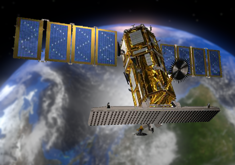
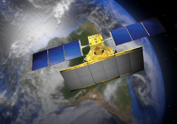
KOMPSAT-5 (also known as ARIRANG-5) carries X-band synthetic aperture radar (SAR) for earth observation, and is capable of day-and-night imaging under all weather conditions. KOMPSAT-5 is part of the Korean National Development Plan of MEST (Ministry of Education, Science and Technology) which started in 2005. The project is being developed and managed by KARI (Korea Aerospace Research Institute). KOMPSAT-5 is the first Korean radar satellite developed by KARI through the collaboration with Thales Alenia Space Italy, developer of COSMO-SkyMed SAR payload. KOMPSAT-5 provides three operation modes: High Resolution Mode (spotlight mode) to provide 1 m resolution with a 5km x 5km footprint, Standard Mode (strip mode) to provide 3 m resolution with a 30km wide swath and Wide Swath Mode (ScanSAR mode) to provide 20m resolution with a 100km wide swath. KOMPSAT-5 was launched on August 22, 2013 from the Yasny launch base of Russia and is expected to complete the calibration and checkout of the radar instrument and ground data processing chain by the end of February 2014. KOMPSAT-5 will be operated to provide products for various applications such as security and defense, image interpretation, mapping, land and natural resource management, environmental monitoring, disaster monitoring and more. The commercial data from KOMPSAT-5 are expected to become available starting in the second quarter of 2014. The KARI is responsible for the operation and public use of the KOMPSAT-5 data, and Satrec Initiative is in charge of commercial marketing of data generated by the KOMPSAT constellation, including KOMPSAT-2, KOMPSAT-3 and KOMPSAT-5. Interestingly, KOMPSAT-5 is the fourth (not fifth) satellite in the series. There is no satellite with numeral 4 because the Sino-Korean word for the number four, 'sa', is a homonym of the Chinese character for death.
Mohammed VI-AThe Mohammed VI-A imaging satellite is Morocco’s second satellite in orbit and their first dedicated to high-resolution imaging. The satellite launched from Kourou, French Guiana atop a Vega Rocket on November 8, 2017 at 1:42 GMT into a 621 km sun synchronous orbit. Mohammed VI-A is part of a two-satellite constellation, with Mohammed VI-B planned to launch in 2018. The two satellites are planned to be used to observe Morocco’s territory, analyze weather, gather agricultural data, and provide planning for disaster relief for its expected lifetime of 5 years (ending in 2022) with resolutions of up to 0.7m in panchromatic (black and white) mode and 2.8m in multispectral (color) mode in a swath of up to ±30 degrees. Airbus Defense and Space built the 1,100 kg satellite around the AstroSat-1000 model with Thales Alenia producing the 200 kg imaging payload.
|
NuSat-1 & 2The Argentinian ÑuSat earth observation satellites form the Aleph-1 constellation developed and operated by Satellogic S.A. The satellites in the constellation are identical 40 cm × 43 cm × 75 cm spacecraft of 37 kg mass. The satellites are equipped with an imaging system operating in visible light and infrared. The constellation will allow for commercially available Earth imaging and video with a ground resolution of 1m. Additionally, ÑuSat-1 carries a U/V linear transponder called LUSEX provided by AMSAT Argentina (AMSAT-LU) to offer services to the HAM community. The Aleph-1 constellation will consist of up to 25 satellites. The first two satellites were launched on a Chinese CZ-4B rocket on May 30, 2016 from the Taiyuan Satellite Launch Center into a 500 km sun synchronous orbit with an inclination of 97.5°. Four more will follow later in 2016.
|
Pathfinder-1Pathfinder-1 satellite was launched on September 25, 2016 into a sun synchronous orbit onboard India’s Polar Satellite Launch Vehicle (PSLV) from Satish Dhawan Space Center in Sriharikota, India. Spaceflight Industries owns and operates the Pathfinder-1 satellite from its operations center in Seattle. Built by Spaceflight Industries, Pathfinder 1 (and Pathfinder-2) are demonstration satellites for BlackSky’s planned 60-satellite constellation. (Pathfinder-2 is scheduled to launch from Vandenberg Air Force Base aboard a SpaceX Falcon 9.) The first three commercially operational satellites are scheduled for launch in 2017, with the complete constellation on orbit by 2020. The Pathfinder earth imaging satellites are approximately the size of a mini-refrigerator and weigh 50 kg. Equipped with payloads from Harris Corporation, they are designed to image an area approximately 4.4km x 6.6km at 1-meter resolution.
|
PeruSat-1PeruSat-1 is a very high-resolution Earth observation satellite system built for the government of Peru by Airbus Defence and Space of France. The satellite is first of its kind operated by Peru. The spacecraft captures high-resolution imagery to support various activities of the Peruvian Government, including emergency management, territorial planning, oceanography, fisheries, forestry, climate, cartography, mining, geology, health, agriculture and hydrology. The PeruSat-1 spacecraft was launched on a European Vega rocket from Guiana Space Centre (Spaceport) in Kourou, French Guiana, on September 16, 2016. Under the PeruSat-1 programme, Airbus Defence and Space also provided training for Peruvian engineers and technicians on the advanced instruction in space technologies, satellite operation, development of appropriate imaging applications, and other technologies. The satellite provides panchromatic images with 1m resolution and 2m resolution images in four wavelength bands. PeruSat-1 is operated from a new space centre in Peru. The ground segment there also receives and processes imagery and data collected by the spacecraft.
|
Planet Flock
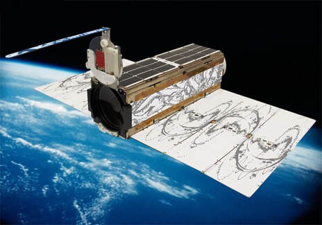
Planet builds and operates a large constellation of small, medium-resolution imaging satellites that has the capability to provide daily coverage of the entire planet. The satellites' design is continuously updated and the constellation refreshed with new satellites. In 2017, Planet launched their 3P Flock and 2K Flock, for a total of 136 satellites! On February 15, 2017, (03:58 GMT) Planet launched 88 satellites, which was the largest fleet of satellites to be launched in history. The Dove satellites, collectively known as Flock 3p, rode aboard an ISRO Polar Satellite Launch Vehicle (PSLV) rocket from the Satish Dhawan Space Centre. The 3P Flock are in a sun-synchronous orbit (SSO) at an approximate altitude of 500 kilometers (310 mi). On July 14, 2017, 06:36 GMT Planet launched another 48 satellites (Flock 2K) aboard a Soyuz-2.1a, also into a similar sun-synchronous orbit. The imagery from Flock 3P and Flock 2K has a resolution of 3.7 meters with a ground footprint 25km x 25km. The satellites are operated from Planet’s control center in San Francisco, and communicate with the ground through 30 dedicated ground stations located around the world. On November 29, 2018, another 16 dove satellites (Flock 3R) launched on an ISRO PSLV-CA rocket into a 500 km sun synchronous orbit. Later in the year another 3 dove satellites was launched on March 12. On a falcon 9 rocket. In addition to the previous two versions of the dove spacecraft there is now the “Super Dove” spacecraft in orbit, which is an upgraded version of the previous two versions.
Pléiades-1A & 1BThe Pléiades system was designed under the French-Italian Optical & Radar Federated Earth Observation (ORFEO) program. Pléiades-1A is a highly agile optical imaging satellite capable of acquiring high-resolution stereo imagery in one pass. Pléiades-1A can acquire panchromatic (black & white) imagery at a resolution of 0.5 meters and multispectral (color) images at a resolution of 2.0 meters. The Pléiades-1A and Pléiades-1B satellites are operated in the same orbital plane, offset 180 degrees from each other.
|
RADARSAT-2RADARSAT-2 has a Synthetic Aperture Radar (SAR) sensor with multiple polarization modes. Its highest resolution is 1 m in Spotlight mode (3 m in Ultra Fine mode) with 100 m positional accuracy. SAR imagery is independent of weather and lighting and is used in marine surveillance, ice monitoring, disaster management, environmental monitoring, resource management and mapping in Canada and around the world. RADARSAT-2 was launched in December 2007. It is owned and operated by MacDonald Dettwiler and Associates (MDA) of Canada.
|
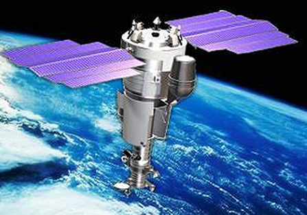
Resurs-DK1The Resurs-DK 1 spacecraft was built by the Russian space company TsSKB Progress in Samara, Russia. It is a modified version of the military reconnaissance satellite Yantar-4KS1 (Terilen). The spacecraft is three-axis stabilized. The satellite was launched on June 15, 2006 on a Soyuz-U rocket out of Baikonur, and is currently operating beyond its original design lifetime of 5 years. Resurs-DK 1 has a downlink data rate to ground stations of 300 Mbit/s, and a maximum daily multispectral imagery coverage of ~700,000 square kilometers. Resurs is Russian for "Resource". The letters DK are the initials of Dmitry Kozlov, chief designer of the first satellite of the Yantar-2K class.
|
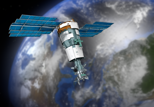
Resurs-P1The Resurs-P1 spacecraft was built by the Russian space company TsSKB Progress in Samara, Russia. It is a modified version of the military reconnaissance satellite Yantar-4KS1 (Terilen). The spacecraft is three-axis stabilized. The satellite was launched on June 25, 2013 on a Soyuz-2-1b rocket out of Baikonur, and has a design lifetime of 5 years. Resurs-P1 has a maximum daily multispectral imagery coverage of ~1,000,000 square kilometers, with a resolution as good as 0.7m (black & white) or color images at 2.8m. Resurs is Russian for "Resource". The letter P stands for "prospecting".
|
Resurs-P2
The Resurs-P2 spacecraft was built by the Russian space company TsSKB Progress in Samara, Russia. It was to be a nearly identical copy of its predecessor capable of acquiring high-resolution imagery up to 1.0 m. The satellite was launched on December 26, 2014 and has a design lifetime of 5 years. Resurs-P2 has a maximum daily multispectral imagery coverage of ~1,000,000 square kilometers with a 3 day revisit rate. Resurs is Russian for "Resource". The letter P stands for "prospecting".
Resurs-P3
Resurs-P3 is a Russian Earth observation satellite. Made by TsSKB Progress, a company based in Samara, Russia, the 5,730-kilogram (12,632-pound) satellite hosts a suite of digital cameras. Resurs-P3 has a camera tuned to image earth in 96 spectral bands. Also a telephoto camera with a focal length of 4,000 millimeters will take the highest-resolution images. Resurs-P3 will collect black-and-white imagery with a resolution of 1 meter, or 3.3 feet, and analysts will resolve objects as small as 3 to 4 meters (10 to 13 feet) across in color pictures.
Risat-1Radar Imaging Satellite 1, or RISAT-1, is an Indian remote sensing satellite which was built and is operated by the Indian Space Research Organisation (ISRO). It uses C-band 5.35 GHz Synthetic Aperture Radar for earth observation irrespective of the light and weather conditions of the area being imaged. The satellite is intended to be used for natural resources management, primarily agriculture planning and forestry surveys, as well as to predict and prevent flooding. It will be used for monitoring paddy plantations and yields in the kharif season and to assist India's food security planning. Pictures from RISAT-1 will be used to estimate the number of hectares being farmed in India, to assess crop health and predict total yield. They can also be used to identify wreckage from aircraft which go down in forested areas. RISAT-1 can collect images with a resolution as good as 3 meters.
|
SkySat-1With 15 satellites in orbit, and more slated for launch, SkySat is a constellation of sub-meter resolution Earth observation satellites owned by Planet Labs. The satellites operate in a polar inclined, circular orbit at approximately 450 km above the earth and are the first of a planned 24-satellite constellation.
|
SkySat-C1, C2, C3, C4, C5, C6, C7, C8, & C9
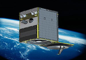
SkySat C1 to C5 are commercial Earth observation satellites by Skybox Imaging, licensed to collect high resolution panchromatic and multispectral images of the earth. The satellites operate in a polar inclined, circular orbit at approximately 450 km above the earth. SkySat C1 is the first of 19 operational Earth Observation Satellites in the initial constellation operated by Terra Bella (formerly Skybox imaging) to collect high-resolution panchromatic and multispectral images and video of Earth to be offered on the commercial market. Imagery collected by Terra Bella comes to use in environmental applications, monitoring agriculture and forestry, tracking natural resources, and asset tracking. A pair of prototype satellites were launched in 2013 and 14 atop Russian Dnepr and Soyuz 2-1B rockets to demonstrate the satellite platform, an in-house development by Terra Bella with production switching to Space Systems Loral for the operational birds. Compared to the two prototype satellites, SkySat-C1 stands 15 centimeters taller, is 30 kg heavier and hosts more efficient reaction wheels and a propulsion system provided by SSC Corp.’s ECAPS division. Also, the imaging payload of the operational satellites features smaller pixel sizes to improve image quality. SkySat covers a ground swath 8km wide and achieves a resolution of 90cm for panchromatic imagery and 2m for multispectral images. Video acquisition in panchromatic mode uses a 30fps frame rate and reaches a resolution of 1.1 meters. 90 seconds of video can be collected from the same location by slewing the satellite to compensate for its orbital motion.
SPOT-6The SPOT-6 satellite built by Astrium was successfully launched in September 2012 by a PSLV launcher from the Satish Dhawan Space Center in India. SPOT-6 is an optical imaging satellite capable of imaging the Earth with a resolution of 1.5 meter panchromatic (black and white) and 6 meter multispectral (color) and will offer imaging products to customers in defense, agriculture, deforestation, environmental monitoring, coastal surveillance, engineering, oil, gas and mining industries. SPOT-6 is owned and operated by the French company Spot Image.
|
SPOT-7
The SPOT-7 satellite built by Astrium was successfully launched in June 2014 by a PSLV launcher from the Satish Dhawan Space Center in India. SPOT-7 is an optical imaging satellite capable of imaging the Earth with a resolution of 1.5 meter panchromatic (black and white) and 6 meter multispectral (color) and will offer imaging products to customers in defense, agriculture, deforestation, environmental monitoring, coastal surveillance, engineering, oil, gas and mining industries. SPOT-6 and SPOT-7 are phased approximately 90 degrees apart in the same orbital plane to maximize revisit rates to imaging targets around the globe. SPOT-7 is owned and operated by the French company Spot Image.
SuperView 1A & 1B
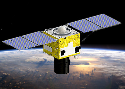
SuperView 1A and 1B are a commercial constellation of Chinese remote sensing satellites owned and operated by Siwei Star Co. Ltd. Beijing Space View Technology Co. Ltd. acts as the exclusive global distributor of the SuperView satellite data for mapping, land use, urban planning, agricultural, oil and gas exploration, maritime, security, defense and intelligence applications. Both Siwei Star and Space View are both subsidiaries of CAST (Chinese Academy of Space Technology) which belongs to CASC (China Aerospace and Science Corporation), the main contractor for China's space program. The SuperView satellites provide imagery with 0.5m panchromatic resolution and 2m multispectral resolution on a swath of 12km. The spacecraft are very agile, providing multiple collection modes including stereo imaging. An onboard data record capacity of 2TB is sufficient to store up to 700,000 km2 of imagery per spacecraft each day. SuperView 1A and 1B were launched on December 28, 2016 on a CZ-2D vehicle from TSLC (Taiyuan Satellite Launch Center), located in the Shanxi Province of China. The satellites have a launch mass of 560 kg each, a design life of 8 years, and are in a sun-synchronous orbit with an altitude of 530km, a 10:30am descending node crossing time, and are phased 180º apart in orbit. SuperView 1A and 1B are the first of a planned CASC constellation of up to 24 Earth observation satellites expected to be on-orbit by 2022.
TeLEOS-1
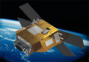
TeLEOS-1 ("teleos" means "perfection" in Greek) is the first commercial Near Equatorial Orbit (NEqO) Earth Observation satellite of AgilSpace, Singapore. Operating at an altitude of 550 km with a 15 degree inclination, TeLEOS-1 offers 1m resolution satellite imagery with an average revisit time of 12 to 16 hours in the equitorial region (+/- 15 degrees latitude). The satellite weighs approximately 400kg, is 3-axis stabilized, can point up to 45 degrees off-nadir, and has a swath width of 12km at nadir. TeLEOS-1 was built by ST Electronics (Satellite Systems) Pte Ltd., Singapore. TeLEOS-1 was launched on December 16, 2015 (12:30:00 UTC) on a PSLV-C29 vehicle of ISRO from SDSC (Satish Dhawan Space Center) at Sriharikota on the east coast of India.
TerraSAR-XThe TerraSAR-X satellite provides high-resolution Synthetic Aperture Radar (SAR) imagery with a resolution of up to 1 meter independent of weather conditions and illumination. TerraSAR-X is a joint venture between the German Aerospace Center (DLR) and EADS Astrium. TerraSAR-X was launched in June 2007. With its active phased array X-band SAR antenna, TerraSAR-X acquires new high-quality radar images of the Earth from a polar orbit at 514 km altitude. TerraSAR-X has excellent location accuracy, and multiple imaging modes (SpotLight, StripMap, and ScanSAR). The planned operational life span of TerraSAR-X was 5 years, which it surpassed in 2012.
|
TripleSat - 1, 2, & 3DMC-3 stands for Disaster Monitoring Constellation 3 and represents three high-resolution optical Earth imaging spacecraft. Satellite Technology Ltd. built the 3 identical 350 kg satellite. The three satellites will form a new constellation, DMC3, designed to meet 21AT’s Earth observation requirements of a one-meter ground resolution in the panchromatic and three-meter resolution in the multispectral bands. The coverage from the three satellites will be able to revisit a given area daily. DMC International Imaging will use this constellation for change detection, disaster monitoring and response planning.
|
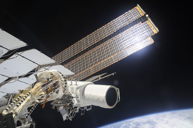
UrtheCastUrtheCast Corp. is a Vancouver-based, publicly traded technology company. UrtheCast’s two cameras were built by RSC Energia and installed on the International Space Station’s Russian Zvezda module by Russian cosmonauts during two spacewalks. The MRC camera produces 50km-wide swaths of 5.5 meter resolution still imagery and points straight down, while the HRC camera is pointed using a precision pointing platform and can generate 1.1m resolution full color Ultra HD video. Video and still image data captured by the cameras will be downlinked to ground stations across the planet and displayed on the UrtheCast web platform or distributed directly to exclusive partners and customers. UrtheCast imagery of Earth will allow for monitoring of the environment, humanitarian relief, social events, agricultural land, and more.
|
VNREDSat-1
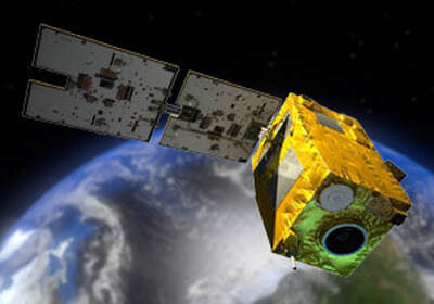
VNREDSat 1 is an Earth observation satellite on a mission to survey the planet with a high-resolution optical camera for the Vietnamese government. Astrium Satellites built the 254-pound (115-kg) spacecraft in an agreement with the Vietnam Academy of Science and Technology. Funded mostly by overseas direct assistance from the French government, VNREDSat 1 is Vietnam's first Earth observation satellite. Vietnam will use the spacecraft to better respond to natural disasters, manage the development of natural resources, and observe the effects of climate change, according to the VAST website. The satellite's camera has a resolution of 2.5 meters, or 8.2 feet capable enough to see cars and trucks from orbit more than 400 miles (644 km) above Earth.
VRSS-2VRSS-2 is the third Venezuelan Satellite and the second Venezuelan remote sensing satellite (after VRSS-1). The Satellite was Launched into a 645 km sun synchronous orbit on October 9, 2017 at 4:12 GMT on a Chinese Long March 2D rocket from Jiuquan Launch Center. VRSS-2 is capable of taking pictures with its multispectral (color) camera at a resolution of 4 meters, and 0.98 meters with its panchromatic (black and white) camera. The satellite was built by Chinese contractor China Great Wall Industry Corportation and launched by China National Space Administration (CNSA) after a contract was signed between China and Venezuela in Caracas on October 5, 2015 it is operated by the Bolivarian Agency for Space Activities. VRSS-2 is used to study Venezuelan terrain and support agriculture and disaster recovery.
|
WorldView-1The Worldview-1 spacecraft was designed and developed under the US National Geospatial-intelligence Agency's Nextview Program. The primary mission of the satellite is to provide high resolution black & white imaging capability for defense and intelligence, disaster relief, civil government mapping, land use planning, and visualization and simulation environments. The camera is a panchromatic (black and white) imaging system featuring half-meter resolution imagery. With an average target revisit time of 1.7 days, it is capable of collecting up to 750,000 square kilometers (290,000 square miles) per day ~ an area approximately the size of Chile. WorldView-1 was launched in September 2007. The satellite has a planned operational life of 7 years, which extends to the summer of 2014. WorldView-1 was built by Ball Aerospace and is owned and operated by DigitalGlobe.
|
WorldView-2The Worldview-2 spacecraft was designed and developed to support Digital Globe's existing US National Geospatial-intelligence Agency's Nextview contract. The primary mission of the satellite is to provide high resolution black & white and color imaging capability used for defense and intelligence, disaster relief, civil government mapping, land use planning, and visualization and simulation environments. Operating at an altitude of 770 km with an average target revisit time of 1.1 days, WorldView-2 provides commercially available panchromatic (black and white) imagery of .46 m resolution, and eight-band multispectral (color) imagery with 1.84 m resolution. With its pointing agility, WorldView-2 is able to act like a paintbrush, sweeping back and forth to collect very large areas of multispectral imagery in a single pass. It is capable of collecting up to 975,000 square kilometers (376,000 square miles) per day ~ an area approximately the size of Tanzania. WorldView-2 was launched in October 2009. The satellite has a planned operational life of 7.5 years, which extends to the summer of 2016. WorldView-2 was built by Ball Aerospace and is owned and operated by DigitalGlobe.
|
WorldView-3WorldView-3 is Digital Globe's sixth and most advanced super-spectral, high-resolution agile commercial imaging satellite. The satellite launched on a United Launch Alliance (ULA) Lockheed Martin Atlas V rocket from Vandenberg Air Force Base in California on August 13, 2014. WorldView-3 collects imagery as good as 0.31 meter resolution, making it the world's highest resolution commercial imaging satellite. In addition, WorldView-3 offers the most spectral diversity available commercially and is the first to offer multiple shortwave infrared (SWIR) bands that allow for accurate imaging through haze, fog, dust, smoke and other air-born particulates. The satellite is also the only satellite to offer CAVIS, a cloud, aerosol, water vapor, ice and snow atmospheric correction instrument which monitors the atmosphere and corrects imagery for an unprecedented level of consistency. The satellite and atmospheric monitoring instrument called CAVIS were built by Ball Aerospace. Exelis built the integrated, super-spectral payload consisting of a telescope, sensor and shortwave infrared system, making WorldView-3 the first commercial satellite to carry such capabilities.
|

