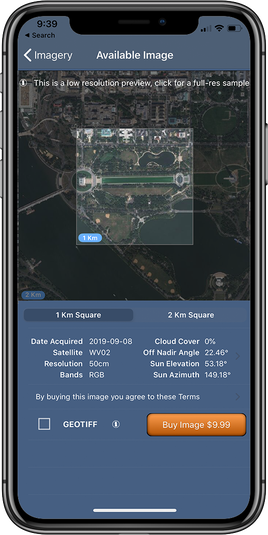
SpyMeSat
  • Home
  • About
    • FAQ
    • Mobile Application
    • Web Application
    • Satellites
  • Features
    • Archive Imagery >
      • Maxar
      • Planet
      • KOMPSAT
      • TeLEOS
      • SkyMap50
    • New Tasking
    • Overflight Notifications
  • Pricing
  • Contact
  • Buy Imagery Now

Maxar

Maxar Imagery Archive

DigitalGlobe, now under Maxar Technologies, is the first company to deliver native 30cm resolution imagery, the highest resolution available for commercial satellite imagery. Images from the Maxar imagery archive range between 50cm and 30cm. The user also has the option to receive their image in a GeoTIFF file format. When you select this option you'll receive the JPEG version within the app and an email with a link to download the GeoTIFF file will be sent to your account's registered email address.
Picture

Specifications:

Image Size
Picture

1km² & 2km²

Resolution
Picture

30cm - 50cm

File Format
Picture
Maxar Imagery can be purchased in GeoTIFF format by checking the GeoTIFF checkbox when you are previewing the image​

Imagery on this page provided by Maxar
Picture
Resources
Picture
Visit the Maxar Website
Picture
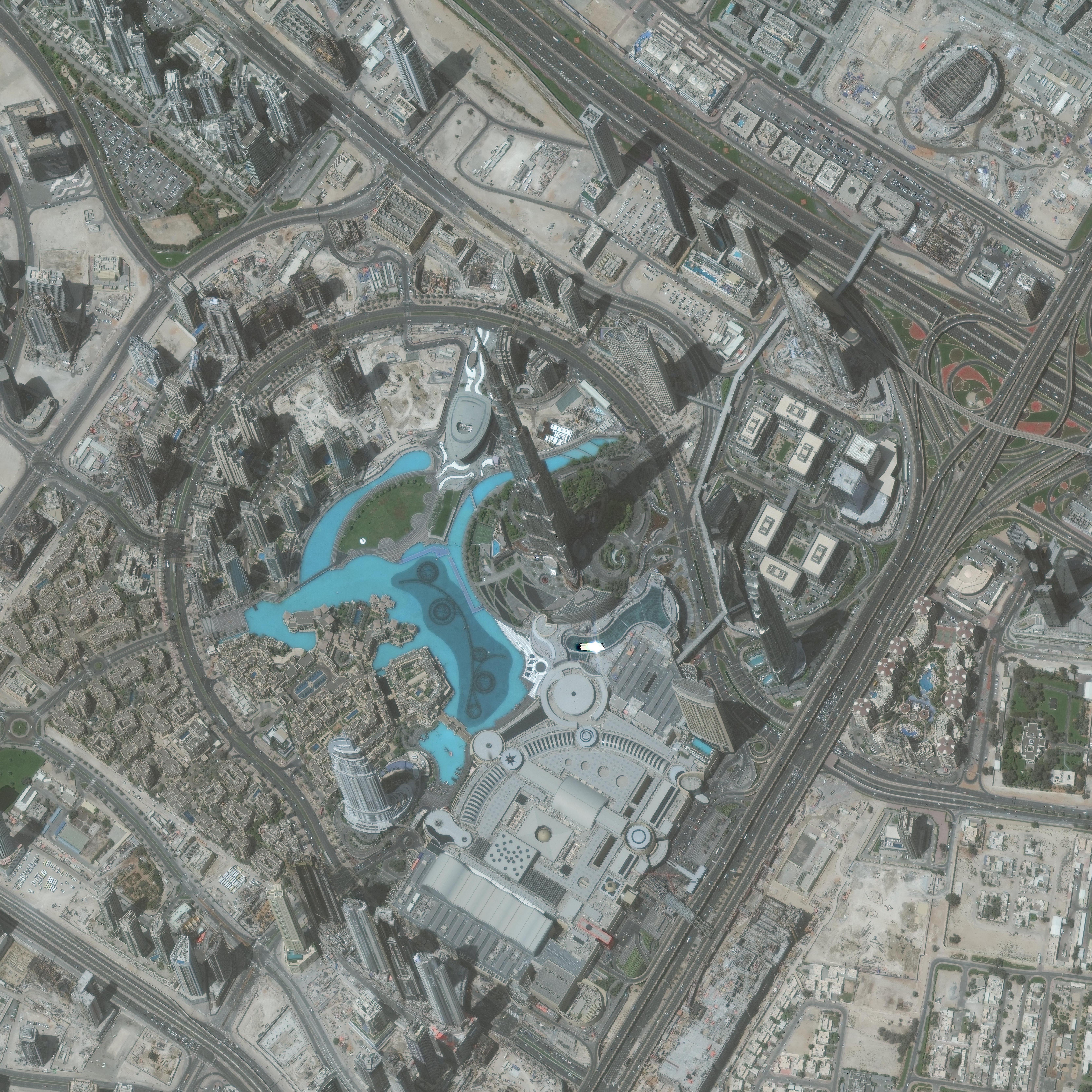
Download a Full-Resolution
​Sample Maxar Image
Picture
Read the Maxar
End User License Agreement​
U.S. Patents 9344994, 9779301, 10853410, 10817561, and 11113330
© Orbit Logic | All Rights Reserved
  • Home
  • About
    • FAQ
    • Mobile Application
    • Web Application
    • Satellites
  • Features
    • Archive Imagery >
      • Maxar
      • Planet
      • KOMPSAT
      • TeLEOS
      • SkyMap50
    • New Tasking
    • Overflight Notifications
  • Pricing
  • Contact
  • Buy Imagery Now