
What is it?
SpyMeSatGov is a custom version of the SpyMeSat mobile app made for National Geospatial-Intelligence Agency (NGA) purposes. It differs from the commercial mobile app in a number of ways. Most notably, it interfaces with the user's own EnhancedView account instead of a commercial imagery archive account, and does not allow tasking.
Who can get it?SpyMeSatGov is a mobile version of SpyMeSat where user's with appropriate government access can receive the satellite imagery associated with those privileges. Any federal U.S. government user can get access to the EnhancedView satellite imagery in the Vantor imagery archive. NGA will review each EV-WHS (EnhancedView Web Hosting Service) account request and grant access. Contractors can also get access with permission by the contract Contracting Officer's Representative (COR).
Where can I download it?
What are the requirements?GEOINT App StoreYou need a Disadvantaged User Account or Austere User Account in order to download apps to devices (like mobile phones) that do not have a hardware token like a CAC card. You must be a US government employee or authorized USG contractor or have a USG sponsor to get one of these accounts.
SpyMeSatGovIn order to download satellite imagery using the SpyMeSatGov mobile app, you will need an EnhancedView account (username and password). To request an EnhancedView account (also called an EV WebHosting Account), use the online form at the following address: https://evwhs.digitalglobe.com/myDigitalGlobeAdmin/RegistrationRequest.html. If you have any questions or issues related to getting your EV WebHosting account, call 866-810-2297, or send an email to deftechsupport@digitalglobe.com. If you are supporting a government mission you have access to EnhancedView Web Hosting Service (EVWHS) at no extra cost.
|
Resources |

SpyMeSatGov FAQ
How do I change my location
To rest the app to your current location select the target icon on the right side of the main map. To set a specific location other than your current location, tap on the search icon on the lower right of the main map and enter an address, point of interest, or Latitude/Longitude coordinates. You can scroll and zoom on the map and drop a pin by pressing and holding a location. Once a pin is added to the map select the pin, then the icon next to the name, and choose ‘Set as new location’. Once a new location is chosen, imaging passes will be recomputed for the new location. Note that satellite image previews and purchases are based on this single SpyMeSatGov specified location, which can be changed by the user any time.
Why does my Imagery page say 'No Image Data was found'?
Your Enhanced View account may not be scoped to the location you have selected. Verify that your location is set to an area within your allowed Enhanced View range.
How do I download a recent satellite image of my current location or any location?
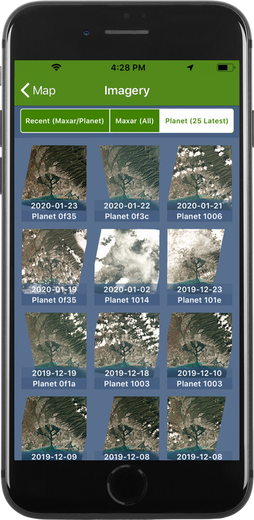
First, set your SpyMeSatGov location (see the FAQ on changing location above) to where you want to center your image, then tap on the small SpyMeSatGov icon at the bottom of the main page to bring up the Satellite Imagery page. (If you are not logged in to your SpyMeSatGov account, you will be prompted to create one or log in.) You will be prompted for your Enhanced View password, and after entering it a selection of available images of your selected location are shown. The 1Km or 2Km buttons are available once an image is chosen to help decide what size image to download, and note the information about the image including the Date Acquired and Satellite that took the image. If you like the preview and want to download the image, simply tap on the Download Image button at the bottom of the Available Image page. The image will automatically download to the SpyMeSatGov Satellite Imagery page under View. Tap on any downloaded image icon to bring up the full resolution image. Use the Send icon to send the image via email or post it to social media.
What regions have available imagery?
Enhanced View satellite imagery is available globally, but each user must request their region(s) on the EV-WHS account request, with justification. Note that The Geographic area of interest is requested on the EV-WHS registration form. If the user requests worldwide access, NGA may ask for more justification. For USG intelligence agencies, the rules of intel oversight require a PUM for access to imagery in the U.S. Only imagery within the approved region(s) will be available through the SpyMeSatGov app for each user account.
How do I enter my EV-WHS (Enhanced View) account information into the SpyMeSatGov mobile app?
You will be prompted to enter your Enhanced View account information by the SpyMeSatGov app if you attempt to view available imagery. You can also go to the Settings page and select the “Log in to SpyMeSatGov server” button and then select the “Register with Email” button to get to the same Register page within the app. Enter your email address and SpyMeSatGov password (any password you want) in the upper section. In the lower section of the Register page, enter your Enhanced View username and Connect ID.
Note: It is easiest to enter the Enhanced View username and Connect ID by cutting and pasting from the Enhanced View account email or other file on your mobile device, so it is recommended that you forward an email or text note with the Enhanced View data to your mobile device to support this cut/paste approach (to reduce errors and frustration entering long IDs).
Note: It is easiest to enter the Enhanced View username and Connect ID by cutting and pasting from the Enhanced View account email or other file on your mobile device, so it is recommended that you forward an email or text note with the Enhanced View data to your mobile device to support this cut/paste approach (to reduce errors and frustration entering long IDs).
ARE my Enhanced View and Planet passwords saved?
The app will cache your passwords for 30 minutes so that you will not need to re-enter it if downloading imagery from multiple locations, but it does not save it to the server or any other long term location.
Why does my Planet API key disappear when I log out?
The Planet API key is not stored on the SpyMeSatGov database for security purposes and is cleared when you log out.
Why does SpyMeSatGov keep recalculating Satellite Passes whenever I bring it up? It is always computing!
SpyMeSatGov stops running when you close the app or your phone falls asleep. In order to ensure that the user gets a full and complete list of upcoming satellite passes, SpyMeSatGov will restart the calculations if it was interrupted before completion. So don’t close the SpyMeSatGov app until the computations are complete. If your phone is going to sleep in the middle of the computations, then increase the Auto-Lock time (under Settings > General) and/or decrease your calculation window to 6 hours.
Does SpyMeSatGov include all imaging satellites?
No. SpyMeSatGov includes imaging satellites with resolution capabilities of 5m or better for which orbit information is published by NORAD. For the most part these are commercial satellites or publicly-acknowledged government satellites from other countries. For many of them anyone can obtain images (new or archived). No classified imaging satellites (from any nation) have their orbit information published, so these satellites are not included in the SpyMeSatGov app.
Where does the information displayed in SpyMeSatGov come from?
Orbit information comes from the Celestrak website, which is driven by data published by NORAD. The SpyMeSatGov app uses this orbit data to predict the positions of the satellites. Satellite sensor (camera) capabilities come from the individual satellite operator websites or other public internet sources. SpyMeSatGov uses the sensor data to predict potential image resolutions and the field of regard of the satellite. Combining the orbit data and sensor data with basic computations leads to the predicted imaging opportunities and dynamic position and resolution data displayed in the SpyMeSatGov app.
What is Azimuth and Elevation?
Azimuth and Elevation define the position of the satellite relative to your selected location. Azimuth tells you what direction to face and is measured from north (0 degrees) in a clockwise direction, so east is 90 degrees, south is 180 degrees, and west is 270 degrees, etc. Once you are facing the correct direction based on Azimuth you need to know how high up to look, and that is what Elevation tells you. Zero (0) elevation means the satellite is at the horizon, and 90 degrees elevation is straight up, so 45 degrees is about halfway, etc. The Azimuth and Elevation of the satellite will change as the satellite passes over your location, and these changing values are displayed by SpyMeSatGov during possible imaging times.
Will SpyMeSatGov still work when I don’t have internet access?
Yes! SpyMeSatGov automatically retrieves updated orbit information from the SpyMeSatGov server when an internet connection is available, but if the app cannot reach the server for any reason it can work from older orbit data stored in the app. After a few (3-4) days without connecting to the server, the precision of the imaging opportunity computations may start to be affected, however. After a week or more without an internet connection to the SpyMeSatGov server for new orbit data, SpyMeSatGov imaging opportunities should be considered suspect.
How do I register for my Planet account to download satellite images
For U.S. government employees and contractors needing access to Planet imagery, please send a message to PlanetUserRequest@nga.mil to complete the application and agree to terms for an account to download Planet imagery licensed by NGA. If you have any issues with any part of this process or with the SpyMeSatGov app itself, please send an email to spymesatgov@orbitlogic.com for additional support. We are here to help.
Have a question you don't see here?
Let us know if you have any additional questions by emailing spymesat@auria.space